
Looking Up Sunrise Manor Neighbors
A Sunrise Manor neighbor search has a narrow public-record center: surrounding parcels. The best first source is a parcel map, followed by the Assessor and Recorder links for the particular parcel. Those sources can identify an owner of record, legal description, and past title event. Public agendas and community map layers can add local context. They do not prove that an owner occupies a parcel or that every adult in a block is named in a public source.
| Source | What it shows about a block | Access |
|---|---|---|
| Clark County OpenWeb | Selected parcel geometry, adjacent parcels, site address, jurisdiction, owner links, sale facts, and map layers | Free reference map with selection and measurement tools. |
| Assessor parcel record | APN, owner of record, situs, mailing address, legal description, and prior-owner option | Free public search; owner is not automatically an occupant. |
| Recorder index | Grantor, grantee, instrument, date, and legal-description trail for an individual parcel | Official Records online from 1988; microfilm from 1909. |
| HOA GIS layer | Association polygon and name where a parcel lies within a mapped association | County GIS layer; no public member roster located. |
| Town Advisory Board records | Public agendas, minutes, planning cases, board members, and county liaisons | County TAB page and meeting archive; not a membership directory. |
Start with the parcel map because it fixes the geographic question. A tax mailing address can be outside Sunrise Manor. A voter record can be protected. An association name can identify a boundary without identifying members. The same limits make a block lookup more reliable when it stays precise about what every source actually confirms.
Map a Sunrise Manor Block
Clark County OpenWeb provides the adjacency method for a Sunrise Manor block. First locate the subject address in the Assessor search and save its APN. Open that parcel in OpenWeb, zoom to the street segment, and select the surrounding polygons one at a time. Property Information can show the parcel’s site address, jurisdiction, owner name or names, sale date, sale price, and estimated lot size. The map’s legal-description fields help keep the parcels apart when names or postal labels overlap.
- Search the subject situs in the Clark County Assessor and record its APN, situs, legal town, and description.
- Open the APN or address in Clark County OpenWeb, select the subject parcel, and verify the parcel label before moving outward.
- Click each surrounding polygon and record the neighboring APN, site address, jurisdiction, and owner link. Use map browse and the measure tool rather than assuming a dedicated radius tool exists.
- For a title question, follow an individual parcel to the Assessor and Recorder links, then compare the legal description and instrument history.
- Use public community records only for their stated context. Do not infer household membership, voter status, or private association affiliation from a parcel.
The OpenWeb parcel example illustrates the kind of property, jurisdiction, sale, and legal-description fields visible after selection.
Selected-parcel information supports a neighbor search by showing the parcel relationship and record links, not by making a claim about every person at an address.
- Property fields can show owner name or names, site address, jurisdiction, sale date, sale price, and estimated lot size.
- Legal-description fields can show subdivision, book and page, lot and block, and township-range-section.
- Map context can include tax district and census tract alongside zoning, flood, and elected-district layers.
Three-Block Sunrise Manor Neighbor Start
The Assessor address form has a useful local quirk for a small Sunrise Manor neighbor search: when a street number is entered, results include addresses within three blocks. That result set can help find the correct segment before opening the map. It is not the same as a complete block roster. Check the street direction, type, legal City/Town, and exact site address before deciding that a result belongs beside the subject parcel.
Street Name is the required form entry. Street Number, direction, type, and City/Town are optional, and the record preference can show current or present and prior owners. The City/Town field is a legal-boundary clue, not a mailing-city assertion. A Sunrise Manor parcel can have a Las Vegas postal label, so keeping both labels avoids a false mismatch.
Sunrise Manor HOA Neighbor Layer
The County’s HOA GIS layer answers a different neighbor question: whether a parcel falls in a mapped association area. It exposes polygon layers and association names, including Highlands East Community Association and Sunrise Villas VI, VII, and VIII Homeowners Association in indexed values. Use the parcel and map query to verify the boundary. The layer does not supply a public member directory, and a named association is not evidence that a particular person belongs to it.
Highlands East Community Association
The name appears in the official HOA GIS layer and on an Assessor common-element parcel example. Check the parcel card and map boundary for the exact area.
Sunrise Villas VI, VII, and VIII
These association names appear in the County HOA layer. The inspected sources did not locate a public member or resident roster.
Sunrise Acres Water Association
A historic preservation survey identifies this as a local infrastructure and community clue. It is not a resident-membership source.
The OpenWeb map provides the parcel and planning layers that make an association boundary useful in context.
OpenWeb places the HOA layer beside parcel, legal-description, zoning, flood, and elected-district context, which helps distinguish a mapped community from a private list.
Sunrise Manor Neighbor Public Table
Sunrise Manor has a Town Advisory Board rather than a city council because it is a county-administered unincorporated town. The Board’s public material is useful for community context: agendas and minutes may identify planning applications, APNs, street-side descriptions, zoning requests, board members, and county liaisons. That is a civic record of a local issue, not a directory of people who live near a parcel.
The Sunrise Manor TAB page lists meetings at the Hollywood Community Services Center, 1650 South Hollywood, Las Vegas 89110, at 6:30 p.m. on Thursdays before the first and third Tuesdays. It also provides agendas and minutes online. The postal city in that meeting address is a concrete reminder that a Las Vegas mailing label can serve Sunrise Manor.
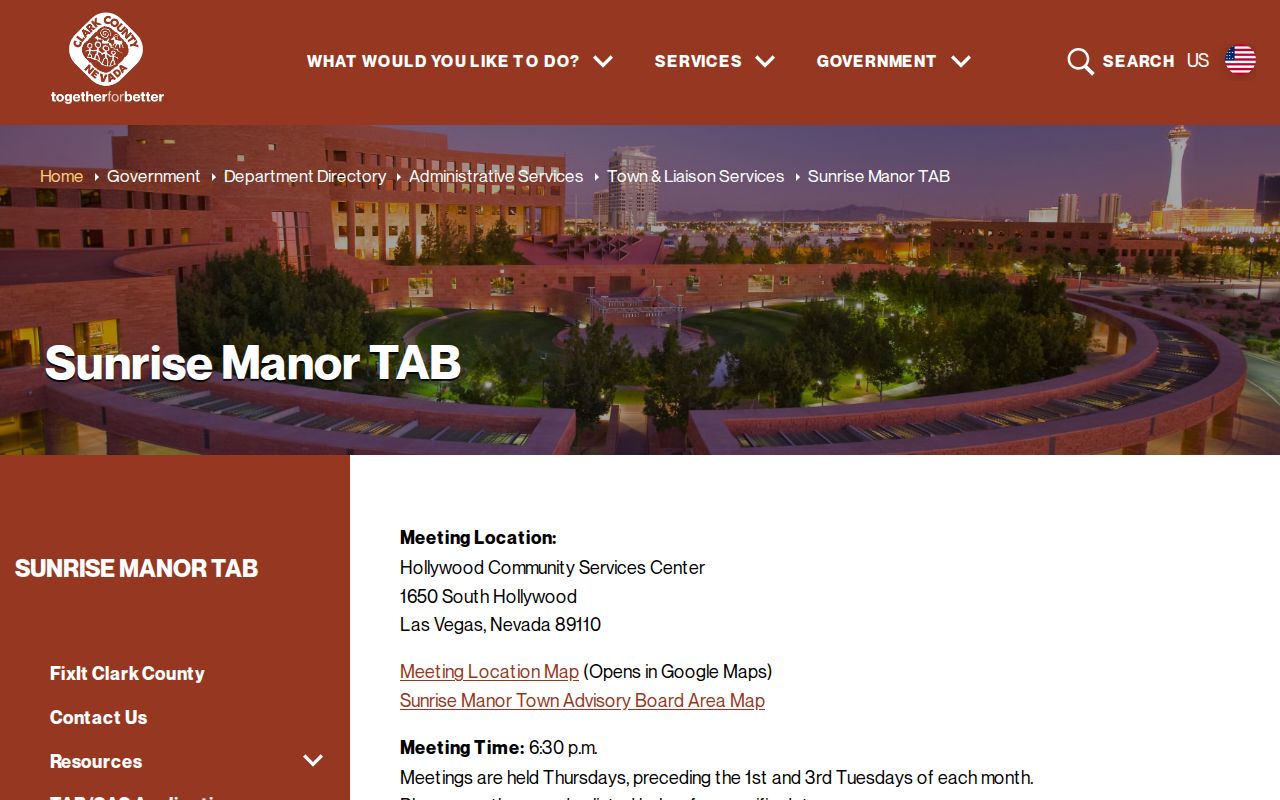
The Board source supplies public civic context for a Sunrise Manor block without converting meeting participation or a planning reference into a residential claim.
Voter Limits for Sunrise Manor Blocks
Nevada voter records have a public and protected split. NRS 293.557 and NRS 293.301 set out the voter-list framework, while NRS 293.558 protects Social Security numbers, driver-license or identification numbers, and voting-related email. A voter can request that an address and telephone number be withheld, and protected-person records have additional confidentiality. Clark County’s public page emphasizes a voter’s own record, representatives, voting history, and requests.
That means the county does not advertise an anonymous function to show all voters in a Sunrise Manor block. Voting history indicates participation, not ballot choices. A name or affiliation entry does not establish a complete household, present physical occupancy, or the identity of adjacent people. Use Elections records only within those limits and never try to reconstruct a protected address from another source.
Compare Sunrise Manor Neighbor Sources
Official parcel records and commercial neighbor tools answer different questions. The official path is slower because each record has a custodian and limit, but it identifies the record type, date, and parcel on which a result rests. A commercial category tool may combine old and new information from mixed sources, merge same-name people, or omit protected data. For a block question, compare the exact parcel and official record before relying on a compiled result.
| Official parcel and civic records | Commercial neighbor category |
|---|---|
| Shows the source record, parcel, legal description, access limit, and date tied to a specific agency. | May combine mixed records without showing a complete or current source chain. |
| Separates owner, title event, mapped location, and public meeting context. | Can merge owners, occupants, former addresses, and same-name people. |
| Respects withheld voter and protected-address records. | May be stale or incomplete and is not an authoritative parcel record. |
For a Sunrise Manor block question, retain the source, date, and exact parcel beside any result. That record trail is what lets a reader distinguish mapped proximity from a claim about a person.
Sunrise Park in Sunrise Manor
Sunrise Park is a useful geographic anchor when a record carries several place labels. The County Parks Locator places it at 2240 Linn Lane, Las Vegas 89156, and identifies the community as Sunrise Manor, District B, in the Northeast quadrant. The park is six acres and dates to 1971. Those facts help reconcile a street, ZIP, community, and district reference without treating a park locator as a resident source.
Use this sort of public landmark to check geography in a neighbor search, especially when the postal city says Las Vegas. Then return to the parcel’s official jurisdiction and legal description. The park label cannot establish that an address is in the same association, census tract, or neighborhood boundary.
Private Data Is Not a Neighbor Lookup
Private household and utility data stays outside the public parcel-map chain. So do delivery data, non-public association rosters, protected voter addresses, and Nevada Safe at Home addresses. The Safe at Home program uses a substitute address and confidentiality mechanism for qualifying participants. Nevada’s public-record law allows access to non-confidential records, but it does not authorize an agency to reveal information another law makes confidential.
For a specific non-confidential county record, a focused Nevada Public Records Act request should name the department, parcel or address, date range, and preferred format. NRS 239.0107 requires a response action within five business days, which may be production, a written denial with authority, or a notice of delay and estimated availability. A request is not a way to obtain a private roster or protected address.